Your Trusted Geospatial Data Services
DAS offers innovative geospatial data services to clients nationwide. Our team of certified GIS experts, photogrammetrists, and surveyors deliver geospatial products tailored to your unique needs. Our experience ranges from local imagery to statewide LiDAR acquisition and processing, demonstrating our team’s ability to skillfully handle projects of any scope and size.
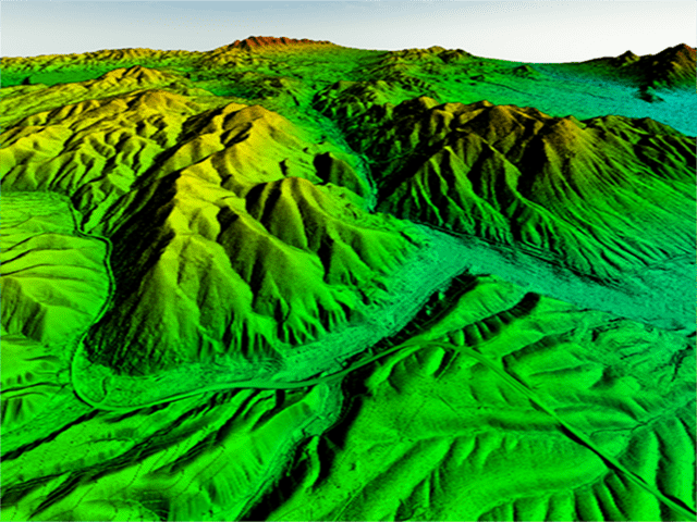
LiDAR Data Collection and Processing
Our team of geospatial professionals specialize in the collection, processing, and organization of LiDAR data to deliver projects of the highest quality and accuracy. We utilize the most up-to-date technology to ensure client confidence and satisfaction throughout a project’s lifespan.
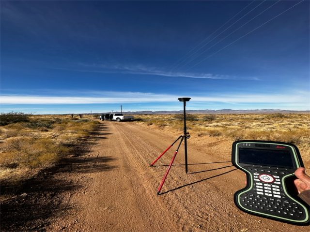
Survey
Geodetic surveying efforts are essential for the most accurate geospatial data. Our team of licensed surveyors and technicians expertly design and execute a variety of surveying methods across many different projects.
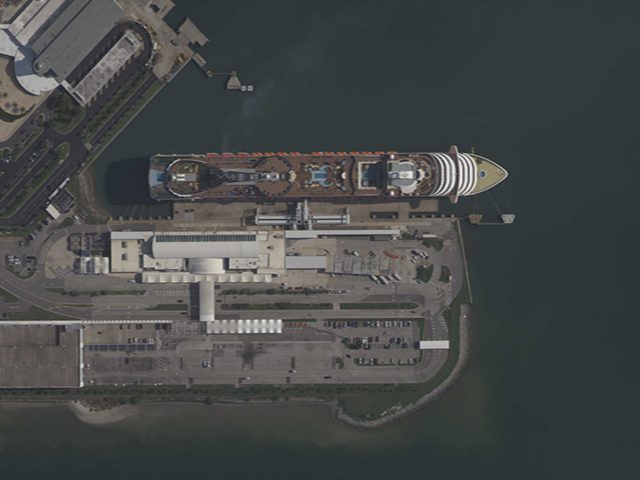
Digital Orthophotography
Digital Orthophotography has become a valuable foundation for the development of GIS layers such as parcel boundaries, transportation networks, hydrography, and more. With its remarkable accuracy and extraordinary detail, it empowers us to effortlessly develop and adjust related data according to the specific needs of our esteemed clients and users.
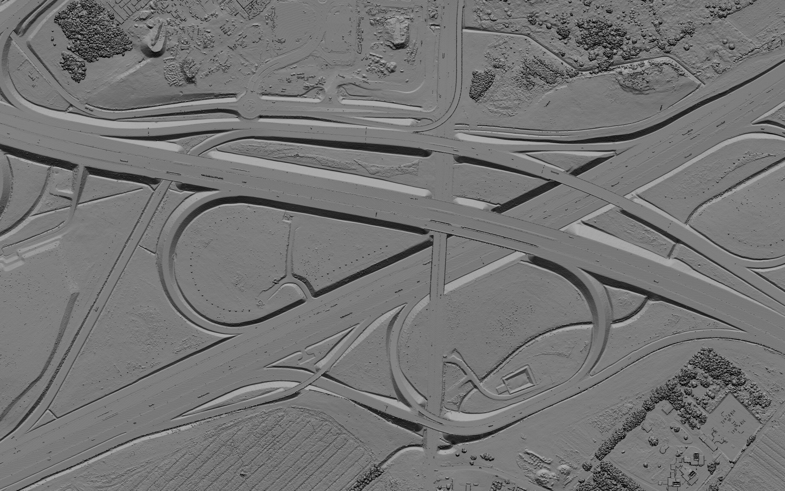
Photogrammetry
We use an advanced digital production process that leverages aerial triangulation techniques to integrate the short-term accuracy of GPS seamlessly. By carefully minimizing the number of ground control points and utilizing aerial triangulation, we achieve the most precise and best-fitting ground results. The extra information added to the system by automatic tie point measurement (APM) leads to very reliable orientation results where photogrammetric measurements serve to control IMU/GPS measurements and vice versa.
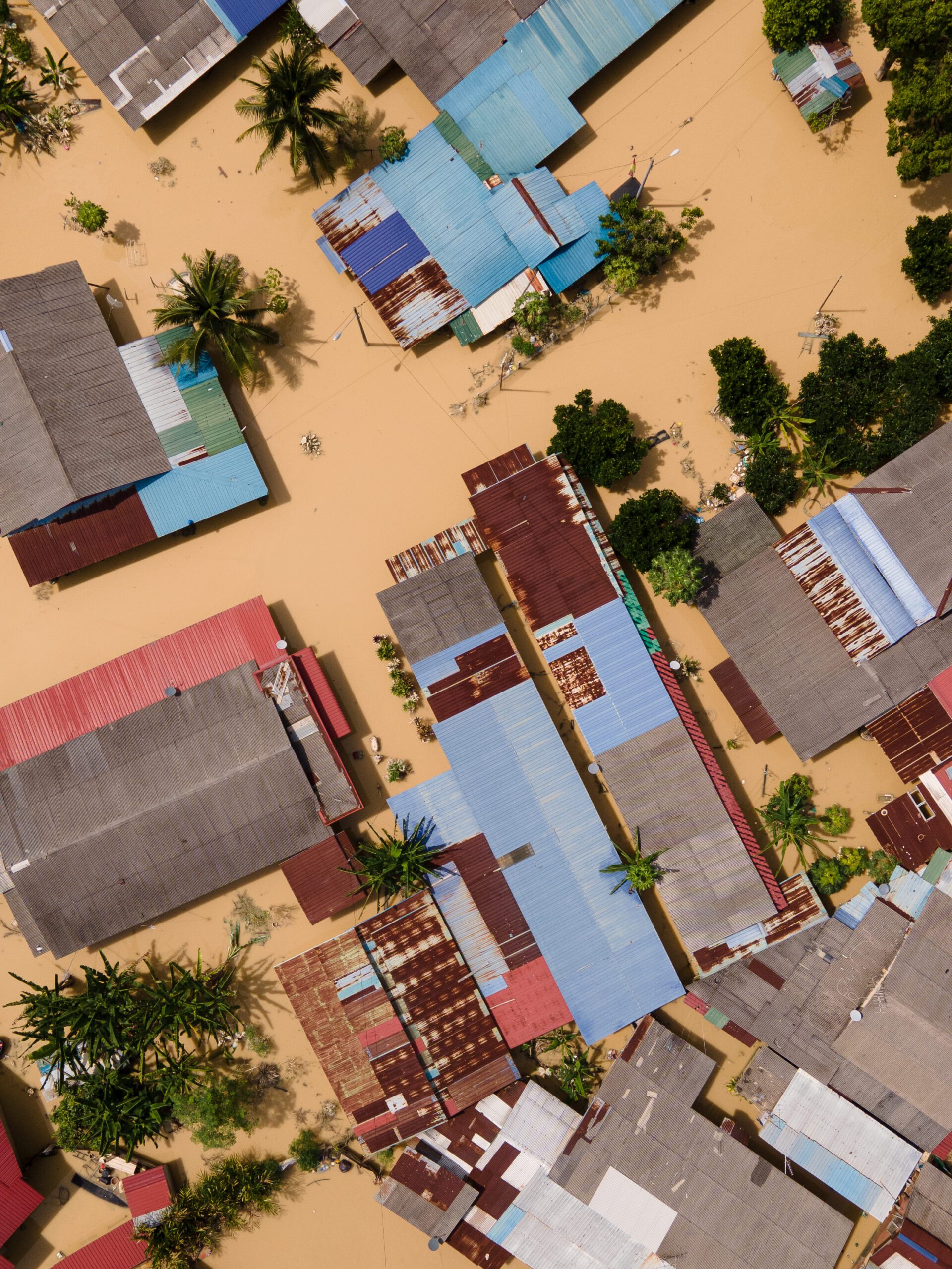
Emergency Response Imagery:
Our close proximity to areas that are susceptible to natural disasters such as hurricanes and tornadoes allows us to respond quickly with current and accurate post-disaster geospatial data. Previously, inefficient response and mobilization after these events hindered first responders and compromised subsequent analysis. Imagery is especially useful in these scenarios as it can provide information that is both useful in real-time navigation of areas affected by catastrophe, as well as before-and-after comparative analysis. DAS stepped in to provide comprehensive geospatial support for all disaster response and recovery aspects.
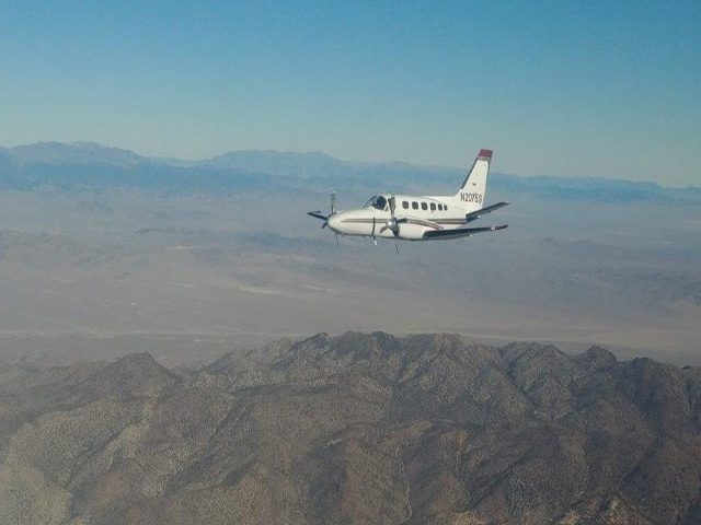
Equipment We Use:
DAS employs three twin-engine aircraft to support our aerial survey initiatives. These aircraft are manned with cutting-edge topographic and bathymetric LiDAR sensors from Leica Geosystems, such as:
- Leica Chiroptera-4 Bathymetric LiDAR Sensor
- Leica TerrainMapper LiDAR Sensor
- Leica ADS100 Airborne Digital Imagery Sensor